Neighborhood Research Report
This document is a neighborhood research report, presenting information for the following areas:
| Address | Radius | Created on | |
|---|---|---|---|
| 3414 W 77th St, Los Angeles, CA, 90043, USA | 1.00 mi | 04/30/2021 | |
| 1967 E Imperial Hwy, Los Angeles, CA, 90059, USA | 1.00 mi | 04/30/2021 |
All reports use the most recent data as of their time of creation.
Table of Contents
- Population & Households
- Housing Units
- Environmental Noise
- Walkability, Bikeability, and Public Transportation
- Nearby Public Housing and Section-8 Properties
- Air Quality
- Pollen Count
- Earthquake Hazard
- Age Groups
- Income Distribution
- Education
- Racial/Ethnic Composition
- Politics and Ideology
- Marriage and Dating
- Pet Ownership
- Crime
- Fatal Car Accidents and DUIs
- Registered Sex Offenders
- Public Schools
- Charter Schools
- Maptimum's Verdict
- Your Priorities
Population & Households
Higher population growth in an area can mean higher demand for housing in the future, resulting in higher price appreciation for houses in that area. On the other hand, it can squeeze the area's infrastructure and resources, and reduce the quality of life in the area.
The average household size shows, on average, how many individuals live in a household.
| 3414 W 7 | 1967 E I | |
|---|---|---|
| Population (Current) | 32,018 | 45,364 |
| Population (5-Year Projection) | 32,085 | 45,852 |
| Yearly Population Growth | 0.04% | 0.21% |
| Number of Households | 11,520 | 9,707 |
| Avg Household Size | 2.78 | 4.67 |
Housing Units
In general, an area with a higher rate of owner occupancy is desirable, because owners take better care of the property and are more financially and emotionally invested in the success of the neighborhood than renters.
| 3414 W 7 | 1967 E I | ||||||||
|---|---|---|---|---|---|---|---|---|---|
| Total Housing Units | 12,310 | 10,470 | |||||||
| Occupancy | |||||||||
| Owner Occupied | 41.45% | 31.96% | |||||||
| Renter Occupied | 52.13% | 60.75% | |||||||
| Vacant | 6.42% | 7.29% | |||||||
Environmental Noise
A Soundscore™ rating is a number between 50 (very loud) and 100 (very quiet) that tells you how loud a location is due to environmental noise.
| 3414 W 7 | 1967 E I | ||||||||
|---|---|---|---|---|---|---|---|---|---|
| Sound Score | 68 (Active) | 64 (Busy) | |||||||
| Sources of Noise | |||||||||
| Airports | Active | Calm | |||||||
| Vehicular Traffic | Busy | Busy | |||||||
| Local Commercial and Community | Active | Active | |||||||
Walkability, Bikeability, and Public Transportation
Walk Score is a number between 0 and 100 that measures the walkability of any address. The higher the score, the less the need for a car to run daily errands.
Bike Score measures whether an area is good for biking. For a given location, a Bike Score is calculated by measuring bike infrastructure (lanes, trails, etc.), hills, destinations and road connectivity, and the number of bike commuters.
Transit Score is a measure of how well a location is served by public transportation.
| 3414 W 7 | 1967 E I | ||||||||
|---|---|---|---|---|---|---|---|---|---|
| Walk Score® | 63 (Somewhat Walkable) | 63 (Somewhat Walkable) | |||||||
| Bike Score® | 51 (Bikeable) | 46 (Somewhat Bikeable) | |||||||
| Transit Score® | 53 (Good Transit) | 63 (Good Transit) | |||||||
| Nearby Transit Routes | |||||||||
| Bus | 10 | 12 | |||||||
| Rail | 0 | 2 | |||||||
| Other | 0 | 0 | |||||||
Nearby Public Housing and Section-8 Properties
The list of subsidized multifamily properties is provided by the U.S. Department of Housing and Urban Development (HUD) and is updated on a monthly basis.
| 3414 W 7 | 1967 E I | |
|---|---|---|
| Number of Properties | 1 | 4 |
| Closest Property (mi) | 0.90 | 0.44 |
Air Quality
Air pollution affects health conditions and leads to a myriad of health issues.
Air quality of a location varies throughout the year and within the day. The numbers provided here reflect air quality at a recent point in time and can be useful when comparing multiple locations.
Air Quality Index (AQR) ranges betweeen 0 and 100. The closer the number is to zero, the cleaner the air.
| 3414 W 7 | 1967 E I | |
|---|---|---|
| Air Quality Index (AQI) | 40 (Good) | 43 (Good) |
| Major Pollutant | PM10 | PM2.5 |
Pollen Count
Pollen is a fine powder produced by trees and plants. Pollen can severely affect people, especially those with different ailments such as asthma and respiratory issues. It can aggravate these existing conditions or cause these issues in high risk groups.
Measuring unit is pollen particles/m3.
Pollen levels vary throughout the year and within the day. The numbers provided here reflect pollen counts at a recent point in time and can be useful when comparing multiple locations.
| 3414 W 7 | 1967 E I | |
|---|---|---|
| Grass Pollen | 11 (Low) | 12 (Low) |
| Tree Pollen | 0 (Low) | 0 (Low) |
| Weed Pollen | 30 (Moderate) | 29 (Moderate) |
Earthquake Hazard
Seismic hazard data are obtained from US Geological Survey (USGS) and use Peak Ground Acceleraion (PGA) to predict the extent of potential damages that can be caused by an earthquake in an area in the next 50 years.
| 3414 W 7 | 1967 E I | |
|---|---|---|
| Earthquake Risk | High | High |
Age Groups
Median age is the midpoint age where half the people in the area are younger than, and the other half older than that.
| 3414 W 7 | 1967 E I | ||||||||
|---|---|---|---|---|---|---|---|---|---|
| Median Age | 38.30 | 27.20 | |||||||
| Age Groups | |||||||||
| 0-9 Years | 12.37% | 19.18% | |||||||
| 10-19 Years | 13.18% | 16.87% | |||||||
| 20-34 Years | 20.47% | 27.69% | |||||||
| 35-49 Years | 17.98% | 17.16% | |||||||
| 50-64 Years | 19.40% | 12.69% | |||||||
| 65+ Years | 16.59% | 6.41% | |||||||
Income Distribution
The median income is the midpoint income, where half the people in the area make less than, and the other half more than that.
| 3414 W 7 | 1967 E I | ||||||||
|---|---|---|---|---|---|---|---|---|---|
| Median Household Income | $48,600 | $36,100 | |||||||
| On Food Stamps/SNAP | 12.66% | 29.42% | |||||||
| Income Brackets | |||||||||
| $0-$25K | 27.81% | 36.70% | |||||||
| $25K-$50K | 22.99% | 26.39% | |||||||
| $50K-$100K | 27.74% | 25.61% | |||||||
| $100K-$200K | 18.01% | 10.17% | |||||||
| $200K+ | 3.44% | 1.13% | |||||||
Education
Education level percentages are calculated for individuals 25 years or older.
| 3414 W 7 | 1967 E I | |
|---|---|---|
| Less than High School | 56.84% | 67.80% |
| High School | 21.30% | 26.84% |
| College Degree | 13.84% | 4.05% |
| Graduate/Professional Degree | 8.02% | 1.31% |
Racial/Ethnic Composition
| 3414 W 7 | 1967 E I | |
|---|---|---|
| Non-Hispanic White | 1.61% | 1.40% |
| Hispanic | 36.96% | 71.55% |
| Black/African American | 59.14% | 26.28% |
| Asian | 0.59% | 0.24% |
| Other | 1.70% | 0.54% |
Politics and Ideology
Most people prefer to live around like-minded individuals. We have collected Presidential Election results at the precinct level (the smallest geographical unit for which voting results are aggregated) so you can observe the voting patterns of the area.
You can also view party affiliation and ideological leaning based on the data and surveys collected by GfK MRI.
| 3414 W 7 | 1967 E I | ||||||||
|---|---|---|---|---|---|---|---|---|---|
| 2020 Presidential Election Results | |||||||||
| Joe Biden | 91.99% | 87.94% | |||||||
| Donald Trump | 8.01% | 12.06% | |||||||
| 2016 Presidential Election Results | |||||||||
| Hillary Clinton | 96.15% | 97.65% | |||||||
| Donald Trump | 3.85% | 2.35% | |||||||
| Party Affiliation | |||||||||
| Democrat | 52.79% | 34.71% | |||||||
| Republican | 8.57% | 7.49% | |||||||
| Independent | 38.63% | 57.79% | |||||||
| Ideological Leaning | |||||||||
| Very Liberal | 16.53% | 13.32% | |||||||
| Somewhat Liberal | 22.00% | 20.64% | |||||||
| Somewhat Conservative | 34.59% | 38.06% | |||||||
| Very Conservative | 26.88% | 27.97% | |||||||
Marriage and Dating
Marital status percentages are calculated for individuals 15 years old or older.
Female to male ratio is calculated for females and males between the ages of 20 and 44.
A ratio greater than 1 shows better dating prospects for men (since women outnumber men), while a ratio smaller than 1 shows better dating prospects for women.
| 3414 W 7 | 1967 E I | ||||||||
|---|---|---|---|---|---|---|---|---|---|
| Marrital Status | |||||||||
| Single, Never Married | 48.79% | 55.20% | |||||||
| Married | 34.54% | 35.27% | |||||||
| Other | 16.67% | 9.52% | |||||||
| Female to Male Ratio | 1.10 | 1.21 | |||||||
Pet Ownership
| 3414 W 7 | 1967 E I | |
|---|---|---|
| Has Dog(s) | 27.42% | 30.14% |
| Has Cat(s) | 11.61% | 14.59% |
| No Dog or Cat | 60.97% | 55.27% |
Crime
Crime indexes are relative to the national average of 100. For example, a property crime index of 200 in an area indicates that this type of crime is twice as likely to occur in the area compared to the national average. However, one should note that the national average includes many small town and rural areas with lower crime rates than major cities.
Property crime involves private property. Examples include burglary and motor vehicle theft.
Personal crime is characterized as a violent crime that results in physical, emotional, or psychological harm to the victim. Examples include assault and battery.
| 3414 W 7 | 1967 E I | |
|---|---|---|
| Total Crime Index | 108 | 193 |
| Property Crime Index | 88 | 156 |
| Personal Crime Index | 232 | 424 |
Fatal Car Accidents and DUIs
Data on fatal car accidents are usually released by government agencies with a two-year delay. The numbers provided below cover the years 2017-2019.
It is advisable to exercise extra caution when driving in areas known for frequent accidents.
| 3414 W 7 | 1967 E I | |
|---|---|---|
| All Fatal Accidents | 6 | 10 |
| Fatal DUI Accidents | 0 | 1 |
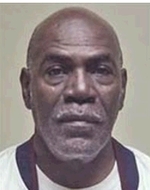
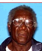
Registered Sex Offenders
| 3414 W 7 | 1967 E I | ||||||||
|---|---|---|---|---|---|---|---|---|---|
| Total Sex Offenders | 57 | 89 | |||||||
| Closest Sex Offender (mi) | 0.09 | 0.03 | |||||||
| Conviction Type | |||||||||
| Offense Against Children | 34 | 56 | |||||||
| Rape | 14 | 11 | |||||||
| Sexual Battery | 2 | 6 | |||||||
| Other Offense | 7 | 16 | |||||||
Registered Near 3414 W 7
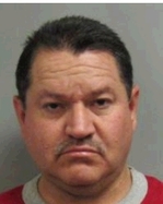
Registered Near 1967 E I
Public Schools
School districts assign children to schools by attendance zones. We have collected information on the schools assigned to each address.
The overall numbers are the average of elementary, middle, and high schools, weighted by the number of students in each level. Detailed information on each individual school is also provided.
Please note that school district and attendance zone boundaries are subject to change. While our data is updated regularly, sometimes it may not reflect the most recent changes. Therefore, please verify the assigned schools with your local authorities.
| 3414 W 7 | 1967 E I | ||||||||
|---|---|---|---|---|---|---|---|---|---|
| Overall | |||||||||
| Avg Test Score | 44.82 | 40.70 | |||||||
| Rank in State (Top %) | 54.82% | 59.32% | |||||||
| Student to Teacher Ratio | - | - | |||||||
| Students with Lunch Subsidy | 85.02% | 90.96% | |||||||
| Elementary School | |||||||||
| Avg Test Score | 24.79 | 18.06 | |||||||
| Rank in State (Top %) | 75.57% | 86.16% | |||||||
| Student to Teacher Ratio | - | - | |||||||
| Students with Lunch Subsidy | 86.74% | 98.29% | |||||||
| Middle School | |||||||||
| Avg Test Score | - | 13.80 | |||||||
| Rank in State (Top %) | - | 89.39% | |||||||
| Student to Teacher Ratio | - | - | |||||||
| Students with Lunch Subsidy | - | 97.99% | |||||||
| High School | |||||||||
| Avg Test Score | 49.89 | 59.57 | |||||||
| Rank in State (Top %) | 49.58% | 37.76% | |||||||
| Student to Teacher Ratio | - | - | |||||||
| Students with Lunch Subsidy | 84.59% | 85.60% | |||||||
Public Schools Assigned to 3414 W 7 (Los Angeles Unified)
| Name | Distance (mi) | Grades | Students | Test Score | Rank in State | Rank Change | Student/Teacher Ratio | With Lunch Subsidy | White | Hispanic | Black | Asian |
|---|---|---|---|---|---|---|---|---|---|---|---|---|
| Seventy-Fourth Street Elementary | 0.91 | K-5 | 430 | 24.79 | 4375 out of 5789 (Top 75.57%) | -281 | 86.74 | 0.47 | 37.44 | 60.47 | 0 | |
| Crenshaw Sci Technical Engr Math and Med Magnet | 1.88 | 9-12 | 678 | 11.70 | 1936 out of 2133 (Top 90.76%) | -294 | 93.36 | 0.74 | 33.78 | 64.45 | 0 | |
| Dr. Richard A. Vladovic Harbor Teacher Preparation Academy | 13.19 | 9-12 | 474 | 99.03 | 16 out of 2133 (Top 0.75%) | 1 | 63.92 | 2.95 | 51.69 | 10.76 | 31.22 | |
| Early College Academy-LA Trade Technical College | 5.62 | 9-12 | 151 | 19.22 | 1643 out of 2133 (Top 77.03%) | 116 | 94.7 | 1.99 | 92.05 | 5.3 | 0.66 | |
| Middle College High | 3.19 | 9-12 | 397 | 68.09 | 578 out of 2133 (Top 27.10%) | -360 | 90.43 | 0.5 | 63.98 | 34.01 | 0.5 |
Public Schools Assigned to 1967 E I (Los Angeles Unified)
| Name | Distance (mi) | Grades | Students | Test Score | Rank in State | Rank Change | Student/Teacher Ratio | With Lunch Subsidy | White | Hispanic | Black | Asian |
|---|---|---|---|---|---|---|---|---|---|---|---|---|
| Grape Street Elementary | 0.32 | K-5 | 468 | 18.06 | 4988 out of 5789 (Top 86.16%) | 578 | 98.29 | 2.99 | 74.15 | 21.15 | 0.43 | |
| Edwin Markham Middle | 0.96 | 6-8 | 698 | 13.80 | 2427 out of 2715 (Top 89.39%) | -80 | 97.99 | 0.57 | 74.64 | 23.5 | 0.72 | |
| David Starr Jordan Senior High | 1.02 | 9-12 | 534 | 29.63 | 1438 out of 2133 (Top 67.42%) | -169 | 98.69 | 0.56 | 82.21 | 16.67 | 0 | |
| Dr. Richard A. Vladovic Harbor Teacher Preparation Academy | 10.47 | 9-12 | 474 | 99.03 | 16 out of 2133 (Top 0.75%) | 1 | 63.92 | 2.95 | 51.69 | 10.76 | 31.22 | |
| Early College Academy-LA Trade Technical College | 7.38 | 9-12 | 151 | 19.22 | 1643 out of 2133 (Top 77.03%) | 116 | 94.7 | 1.99 | 92.05 | 5.3 | 0.66 | |
| Middle College High | 4.01 | 9-12 | 397 | 68.09 | 578 out of 2133 (Top 27.10%) | -360 | 90.43 | 0.5 | 63.98 | 34.01 | 0.5 |
Charter Schools
Charter schools are public schools of choice, meaning that families choose them for their children. They operate with freedom from some of the regulations that are imposed upon district schools. Therefore, if you don't like the public school assigned to your child, you may want to look into charter schools.
Here we have collected information on nearby charter schools that had a better performance (in terms of test scores) than their public school counterparts.
Charter Schools near 3414 W 7
None.Charter Schools near 1967 E I
None.Maptimum's Verdict
Taking all factors into account, we calculated an overall score for the areas. A score of 100 represents an ideal neighborhood.
| 3414 W 7 | 1967 E I | |
|---|---|---|
| Overall Score | 44.82 | 37.85 |
Your Priorities
Decide how important each factor is to you, ranging from Not Important (extreme left) to Very Important (extreme right), and we update the score for each address accordingly.
| 3414 W 7 | 1967 E I | |
|---|---|---|
| Your Customized Score | 44.82 | 37.85 |
| Factor | Importance |
|---|---|
| Owner Occupancy | |
| Income Levels | |
| Education Levels | |
| Crime | |
| School Quality | |
| Quietness | |
| Walkability |
